|
home > news Nautical positioning alternative to GPS Nautical positioning alternative to GPS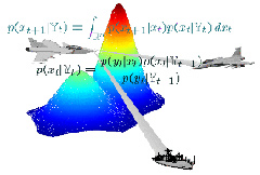
Boat traffic currently relies on GPS technology to determine positioning at sea, but the solution is not always
fool-proof, and submarines can’t take advantage of it because of visibility requirements. At Linköping University,
doctoral candidate Rickard Karlsson has developed a system that uses a ship’s own radar to measure distance to the
surrounding shore, after which position can be determined by comparison with a digital sea chart. For subs, sonar
measurements get compared to digital depth charts to achieve the same effect. The entire system is software-based,
obviating the need for any external GPS hardware, so is not susceptible to interference. This same particle filtering
mathematical algorithm is also expected to be utilized to track industrial robots, avoid vehicular collisions, and
track marine vehicles from aircraft. RSS feeds brought to you by
The Weblogs, Inc. Network is pleased to welcome three new blogs to the network: TVSquad, Cinematical, and Divester. Click Here to read the entire article... Find this article in Google
|